Tuesday, July 14, 2009


Monday, July 13, 2009
GeoSnippits Electronic Bread Crumbs and GPS Tracking

I love making GeoSnippits videos and this one highlights all the reasons I enjoy them so much.
First of all I get to walk around in all sorts of nature. Granted in my neck of the woods it is just that forests and woodlands. Swamps, fields and hills are my norm yet the Oceans and Mountains call to me as well. I consider myself very blessed.
Then top it off by taking hikes with my daughter Miss Geoness who is also our lead photographer and film crew. She loves geocaching as much as I do and even though that usually entails carrying the bulk of the equipment I usually do not get much of a gripe, again blessed.
This adventure we went into the back trails of a nearby park at Benson Lake in Garner, North Carolina. The idea was simple, one of out GeoSnippits viewers had sent in a suggestion to discuss tracking on a couple of GPS units. I decided to use a Garmin 60CSx and a Delorme PN-40. I always used Tracback and other electronic bread crumbs so no problemo. So we packed everything up and headed off into the woods. Though I should note that GeoPuppy Emily was quite upset because she stomps those trails on a weekly basis. Sorry puppy thems the breaks.
Filming went quite smoothly and then a very fortunate bit of luck happened. A biker happened to hear and spot a pair of large barn owls calling to each other. He saw us and showed where they were. I still have not looked up the specifics of this particular owl but I do know they were BIG and only a few feet off of the trails. Just beautiful to watch.
So oh yeah, lets talk video. It goes into detail about how GPS units have what is known as tracking or electronic bread crumbs that do what they sound like. Allow you to walk all over the place and when it is time to go back. Just follow the route on the GPS screen back to where you started. Believe you me it will save you a lot of headache the next time you decide to venture too far fro the parking lot. Hope you enjoy it as much as we did making it.
See you out on the trails,
-HHH
If the video does not show above you can see it by clicking the link below:
Friday, July 10, 2009
Solutions For On-The-Go Paperless Geocaching

I have written several posts, articles and videos about paperless geocaching solutions and they are to this day functionally sound. The solution of that time was to utilize an application on your home computer like EasyGPS or GSAK among others and to load the waypoints onto your GPS and gather the geocache information on your PDA device. That way you did not need so much paper and all the information was still at your fingertips. As they say, that was then - this is now.
If you want to REALLY go portable and paperless you are going to have to upgrade a few things and when you do you will never want to look back to the ways of the past again.
I'm talking real portability on the fly which is going to be great if you are on vacation, on the road or you simply need the latest and greatest geocaching information hot and fresh.
Here is what I came up with:
Bye - Bye PDA, Hello Netbook
PDAs are great little helpers but it is time to turn in that old Palm or Handspring for a nice netbook. I just purchased a real nice one that has bluetooth and WiFi with a 160 gig hard drive for a smidgen over $300.00. PDAs still can cost that much today. The one that I am currently typing this on is a Dell Inspiron Mini with 1 gig memory and the aforementioned 160 gig hard drive. It has the power and the memory to run any application that I have at home on my PC but now it's portable with the bluetooth / WiFi connectivity.
Smart Phones Rock
I am sure there are dozens of smart phones out there that have bluetooth functionality. My BlackBerry Curve 8310 works great. It not only has the bluetooth but a built in GPS as well. So even if you still have your trusty GPS unit out there you can use applications like GeocacheNavigator or CacheBerry as backups or companions while geocaching. The main thing is that you are able to connect from your smartphone to your netbook via bluetooth.
Connectivity is the Key
Having WiFi on the netbook is a very nice thing. You are able to work pretty seamlessly with a WiFi hook-in and yet you are immediately limited to places that actually host WiFi. If you have it for your netbook then you have an advantage but what about when you are out and about with no hotspots are available? Read on.
Using your SmartPhone as a Modem
You are really going to have to do some research on this but there are a lot of success stories of people (including myself) who have been able to do this WAP connection. Meaning using your smartphone as a modem so your computer can hook into the Internet. I am going to give you the link I used to get mine working. Your success is going to depend on your phone carrier and the model phone you have. If this does not give you what you need check out the Internet for more details. It is out there you just have to look for it.
Here is the link I used:
Before you start using the Internet Access of your smart phone you should make sure that you have Unlimited Internet Access otherwise this could cost you more than just a pretty penny. Internet media is charged by the meg and can add up quickly. This is not the same as texting charges which are separate. When all is said and done you should be able to connect to WiFi networks and Bluetooth WAP connections from your netbook to the internet.
GSAK (Geocaching Swiss Army Knife)
GSAK is a very nice application used by geocachers that you should be able to run on your netbook without a hitch. It is basically a series of databases which holds information from .gpx or .loc based files and stores them for you to query specifics about geocaches. Many people are premium members of Geocaching.com and as members you can be sent a whole series of Pocket Queries which are configured by you and contain geocaches from any area or type you choose. They are then loaded into GSAK and visually displayed in the application itself.
There is a section of GSAK where you can type public logging information about a geocache when you find it. There is another part of that section where you can keep personal notes as well. Then when you are ready you can upload the public logging information to geocaching.com when ready.
How It All Comes Together
The netbook computer will have complete portability because it will have access to both WiFi hotspots and WAP connections through your smartphone. This will allow access to the internet for places like geocaching.com, google earth, etc. You will utilize pocket queries or standard queries through geocaching.com and store them into a geocaching application like GSAK. Once loaded into GSAK you can log your geocaching and personal notes per geocache then load them into geocaching.com any time you would like. So in a sence you have a mobile version of GSAK at your fingertips. If for some reason you do not have access to the Internet because of interference like high foliage, buildings, mountains, etc. You still have access to the GSAK database and can still pull geocache information.
After figuring out where you want to geocache you can download from your notebook into your different GPS devices both handheld and road. You will have access to a host of macros, filters and other criteria to choose exactly what and where you want to geocache.
All this and more can be achieved and you didn't have to use a single scrap of paper. In fact your notebook will be the center of your geocachemobile's headquarters.
See you out on the trails and BTW I typed all of this in a nice shaded park, miles from any WiFi hotspot. Ahh the joys of technology when it works.
Have fun and see you out on the trails,
HHH
Wednesday, July 1, 2009
HooHaa Travel Bug Racer Just A Nut Back On The Road

Well I had pretty much written off my TB Racer "Just A Nut" in the HooHaa Travel Bug Race.
You see "Nut" was taken overseas and at the time I thought, "fantastic", then it could really chalk up some miles. How wrong I was. Sure currently has about 3500 miles under it's belt but it was dropped on the western shore of a western island from the western side of Scotland. Lets just say that this was the only geocache on this particular island and it was well, isolated. So there it sat, perfecting it's Scottish accent and learning about haggis. For seven months it waited to be liberated from it's geocaching tomb.
Then, a couple of days ago the lid opened and a geocacher by the name of Skihog found it and now is taking Nut to other places. Hopefully far away from this Isle.
More details to come once I find out where Just a Nut will land. The great thing is now at least it is on the move again. Stay Tuned...
When Hard Drives Attack

Howdy Folks,
Well if you have been wondering where my posts have been in the past week the answer is Boof. Yes boof, that wonderful noise humans make when their computer hard drives die on them. Sure there is a lot of colorful language before the actual boof but when all the tantrums and curses are silenced and you realize there is nothing you can do but fix the situation. You finally sit down, look at the blank computer screen and go "Boof".
Needless to say the trip to the mountains was replaced by figuring out how to install and 'get running' a new 1 Terabyte SATA internal hard drive, loading all the necessary drivers, loading the operating system (after 2.5 hour format), loading the rest of the needed drivers and finally delving into the long and winding road of loading all my very much needed applications. Phew.
I lost count on how many 3 am evenings I had getting everything back in running order. Thank goodness Gmail never deletes emails because all my registry product keys were in there.
Yeah, yeah I know that if I had a backup of the entire hard drive it would have taken a bunch of pain out of the process but and you knew there was a but. I was happy that I had a backup of the important files like pictures, my GeoSnippits vids and pieces that make the vids, important documents, etc. were all in place. It should be interesting because I have a 500 Gig external drive to save all my important stuff but now I have a Terabyte internal hard drive. That's a lot of stuff to be saving for the next time. What comes after Tera? Will have to look that one up.
Long story short - Too Late. I should be back in the groove by the weekend and out on the trails geocaching. Hope to see you there.
Wednesday, June 24, 2009
GeoSnippits Videos Mentioned On FindMe Movie Insider

It was announced on Twitter earlier in the week that our very own GeoSnippits videos are going to be featured on Michigan Magazine TV coming soon. Well great news travels fast and The TMP Insider helped spread the news even further. TMP (Trost Moving Pictures) are the makers of the geocaching thriller movie "Find Me".
GeoSnippits happens to be featured on their Geocaching 101 section of the films web page to help viewers of Find Me better understand what geocaching is and to help entice everyone to give geocaching a try.
Here is some of what they said....
GEOCACHING 101 We just heard today that Head Hard Hat, the star of the Geocaching 101 teaching section on our site is going to have one of his videos featured on Michigan Magazine TV. Congratulations HHH, and if you haven't checked out the Geocaching 101 section yet, you better go now before he gets too famous! In the lower left hand corner of: www.FindMeTheMovie.com you'll see a link you can click for Geocaching 101. ... You can get all the juicy tid bits, FIND ME behind the scenes goodness, contest information and more by going to the FindMeTheMovie Website and send in your email address to become a true TMP Insider. Go there now before you miss something really important. |
GeoSnippits Video - Planning A Geocaching Route - Road Trip To The Ocean

Oh man, there is nothing like a road trip and this one was extra special for me cuz we were going to the ocean. What a great opportunity to do a GeoSnippits episode about Planning a Geocaching Route. That is where you map out a plan of the roads you are going to travel on from your starting point to your destination and if there are any geocaches nearby you can pick them up. Great idea!
We planned a road trip from Raleigh, NC down to the east coast and Kure Beach, NC. This is about a two hour trip. Along the way we did some cool geocaching and ran into some rather interesting things along the way. You will have to check out the video to see what I mean.
If you are interested in a great geocaching phone app you can also see GeocacheNavigator by Trimble in the video. I use it all the time and highly recommend it.
If the player is not available above you can use this link to see the video:
So sit back, relax and enjoy the show. Hope this is a much fun to watch as we had making it.
Monday, June 22, 2009
HeadHardHat's Garmin Mobile for Blackberry Review

Not too long ago some viewers wrote in and asked if I had tried out the Garmin Mobile application for Blackberry phones. Hmmm, did not even know that Garmin had a mobile app out so I was intrigued.
Taking Garmin Mobile For A Spin
First I loaded Garmin Mobile onto my Blackberry 8310 without a hitch. Not unexpected yet to me always a good start. Then I cranked it up and the familiar Garmin Trademark peered through a background of black. If you are interested in trying the GM out for yourself there is currently a seven day trial period. Since I was just giving a good once over that is what I started out with and you are greeted with the number of days you have left in your trial and the option to purchase on the spot.
I clicked continue and was immediately greeted with the WARNING about not trying to operate this application while driving. “Why No – Never”, says I as I click the OK button. Then something quite startling happened. The screen displayed looked exactly to the interface I am very used to on my Nuvi GPS unit. I mean exactly the same. That gave instant recognition and an ease that the learning curve should be almost nil. This was great because I wanted more time testing and less trying to learn how it works.
Because the application mirrors the Garmin Nuvi I set my car GPS to ride side by side with the mobile unit on my phone. This would in my opinion give a fairly good comparison. I had a few performance suspicions already preset but we would have to see if they came true. For example if you use a Blackberry application like Google Maps, Blackberry Maps or AT&T Navigator there are issues with speed of the map updates and a bit of slowness when approaching a street while driving. They always seemed just a step or two behind, which at times can be a bit irritating. That is one of the main reasons I liked a road GPS like a Nuvi because the processor and map updates flowed much smoother.
Real Time Functionality
Right off the bat I was very pleased with some functionality that exists with Garmin Mobile that I did not have on my Garmin Nuvi. For example because it is running on a GPS enabled phone with Internet connections you have access to pleasantries like current weather, traffic reports, airport flight statuses and even a place to upload and view street level photographs called Panoramio. Not earth shattering innovations but nice to have none the less.
Road Trip Test
Next I took both units on a 15 mile road trip to compare and report. It consisted of five different waypoints with two of them being via points. Via points are waypoints that are requested to stop before reaching your actual destination.
 POI (Points Of Interest)
 Maybe it was because it was around noon and I was hungry
but my first stop was a Fast Food restaurant. It was just a subtle thing but I really liked that under the Food POI Garmin put the first category to choose from was Fast Food. That is normally the category I go for and it was sweet to see it on top of all the rest. Nice move Garmin.
After loading the same destination in both units I was off. There were slight differences like the actual map display was a bit different on the GM unit. For example the default zoom is three and at three it does not show the side streets. This was a bit distracting at first and I realized that this must be to keep the unit from downloading the mappings so often on long trips. The idea in my mind is when you do get down to where you would have to turn you simply click the '+' sign to zoom in one and you were set. A slight extra step but when you consider that you are using a phone application it really was not too much of an inconvenience.
Results – Turn for turn the Garmin Mobile unit matched the Nuvi exactly. Did notice that the feeling of movement on the GM unit was not as distinct as the Nuvi but again, for a phone application you are not going to have the graphics horsepower as the auto unit.
Local Search
Local Search is a way of using Google and getting the most recent information for POIs you may be looking for. I have noticed that the mappings appear to be Garmin's yearly North America map and that only updates yearly. When you use Local Search you have a better chance of getting the latest and greatest. I used it to find a department store in the next town. It was newer and accurately found it. I also created a via point buy looking for the nearest gas station. One of the cooler features was you can search by gas price. This is not always accurate but it can be a good guide line. The gas station I chose was off by .10 cents from what was posted.
Results – Local Search seems the better way to go when looking for Points of Interest you may not be certain about within the area you are currently driving and the via point functionality works just as nice as the Nuvi device.

Highway Driving
I used the Contact section to find my next destination. This was rather cool because it uses the address book that is already into your Blackberry phone to get the address. You simply choose the contact person, validate the address and go. This is slick in my opinion because sometime you just don't remember the address and this saves some time looking it up.
Results – One of the biggest pluses with Garmin Mobile is how smooth the map uploads are as you drive. In many of the cases I was expecting to see the upload/download arrows and did not yet the driving map continued on without interruptions unlike other viewed GPS mapping applications. On the flip side I did notice that a new section of freeway that has been in place about a year did not show up while driving. Which tells me that Garmin is using their mappings. I have seen free GPS map applications like Google Maps having more current maps. Not a show stopper but if they have Google working with them would it not be better to use the most up to date mappings?
HeadHardHat's Conclusions
Pros
- Fast and almost seamless updates to the mappings while driving.
- Real time accessibility to the Internet which gives you the most current information available.
- Many little niceties like street voice audio and familiar Nuvi application interfaces.
Cons
- Pricing is a bit steep. $99.00 one time fee is per the life of the phone. If you change phones you null the contract and have to purchase a new contract at full price.
- If you are in areas with phone dead zones you are going to have issues. There is no way to upload/download maps without a connection.
- Default zoom is set to 3 which makes the user have to zoom in to see local streets (annoying).
HeadHardHat's Final Thoughts
Overall I am very impressed with the Garmin Mobile application. It truly is like having an automobile Nuvi GPS in your pocket. This I feel boils down to your need of usage for an application like this and the $99.00 price tag.
I already have a Nuvi GPS in my car and currently very happy with it. Which means that this particular application would be used for travel. If you cannot pack your auto GPS while travelling this would be a perfect solution. Then again there are phone applications that get you from here to there for free. I am personally going to hold off purchasing this application because even though it is a sweet thing to have, the overall usage just does not currently seem to fit my needs. Your views and needs of course may be different. Give the seven day trial a try and see for yourself. http://www8.garmin.com/mobile/mobilext/
HeadHardHat host of GeoSnippits Geocaching Tutorial Videos frequently does reviews for all types of gadgets, gizmos and applications. Be sure to Google headhardhat blog to see his latest blog and video posts. You can contact him at headhardhat@gmail.com.
Please don't forget to visit our GeoSnippits Geocaching Tutorial Videos Website at http://www.geosnippits.com/
Sunday, June 21, 2009
Taking a Quick Ocean Cool-off

Sent via BlackBerry by AT&T

Sunday, June 14, 2009
The Best FREE Topo Road Map For My Handheld Garmin
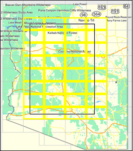 This discussion is for those of us who could use a really good topo map for geocaching which can be loaded on their Garmin GPS hand units.
For me when I purchased my Garmin 60CSx the base map which is included seems a bit lacking. It contains the main interstates but does not include simple highways let alone standard streets. I found this unusual because my Garmin Vista's base map had more than the 60CSx.
Either way the purpose for my 60CSx GPS was for geocaching and overall it works great. Yet sometimes I really wanted to have a topo view that showed if a geocache was on this side of a stream, river, pond or that. Sure you can fork over $80 - $100USD for one of Garmin's North America maps but I was looking for a more inexpensive solution and I believe I found it.
If you go to GPSFileDepot and select your country and/or state several options for free map addons become available to you. These add ons work with the MapSource software that should have come with your GPS unit. Once loaded on your PC you can select the map areas you want and load them onto your GPS. I highly recommend you purchase an SD card for the advantage of extra storage space for the saved maps on your GPS.
One of the free street maps that I liked is called Ibycus USA Map. It works well with the Garmin 60CSx but the auto road features do not. It is more of a template that rides on top of the original base map.
 For US topo maps and depending what part of the country you are in is a set of maps from different parts of the Unites States. For North Carolina was South East United States. It will be renamed for what ever state you choose. The reason I liked this one so much was because it shows all the water marks. Right down to the small streams, ponds and other water areas that sometimes get missed. Again it is an overlay that rides on top of the base map but it really makes the difference while geocaching.
So the choice as always is yours. You can fork over the money and get fine maps from Garmin or if you would like a nice solution that costs you nadda. This is a great way to go.
See you out on the trails.
Please don't forget to visit our GeoSnippits Geocaching Tutorial Videos Website at http://www.geosnippits.com
Saturday, June 13, 2009
Urban Geocaching Has It's Own Unique Challenges

Sent via BlackBerry by AT&T
Friday, June 12, 2009
Checking Out The AllSportGPS Phone App by Trimble
 This is going to be an ongoing series because I do not just intend doing only a review and GeoSnippits episode on this neat application. This is going to be used to keep track of me getting back to a more healthier lifestyle and you can come right along with me.
Let's face it... I'm fat. I know I'm fat, if you have seen my videos or photos you know I'm fat and I admit it. With that being said it also means that I need to work on better health ideals and I need an easy and convenient way for me to track my exercise. Because not only am I overweight - I'm lazy and the last thing I want to do is calculate how far I walked and how much I burned in calories doing it. Heck for most of the time I will be busy getting enough oxygen to my legs so I can keep moving. I don't need the extra aggravation.
That is where an application I have found by Trimble comes in. It is called AllSportGPS and I like it a lot. I am going to give a complete review shortly but let me give you some highlights. I am currently using it on my BlackBerry Curve 8310 with AT&T. The application works on many other GPS enabled phones and you can check out all the availability on their website at the end of this post. The cool part is the application specializes with all sorts of sporting activities. For example I do walking, there is a whole section dedicated to walkers. There is also sections for Running, Road Biking, Mtn. Biking, Trail Running, Boarding/Ski, etc. So if you are outdoors it will track what you do while you are doing it. Very Cool and the best part is it saves each session on your phone and online in a calendar so you can get all the data you want of where you have been and what you burned off while doing it.
Below is a session I just did tonight while walking my GeoPuppy Emily. You can see all your sessions on your phone in real-time and on your PC after it logs the information back to Trimble.
You can see exactly where I walked and if you drill down on the other links below you can see all the details including what I walked, the elevations I walked (yes our neighborhood is that hilly) and other interesting facts. Again all is loaded to their server once you stop your session. Way cool.
Feel free and look around, I don't mind.
So if a product like this interests you check out AllSportGPS here. Oh and they currently have a 60 day try it before you buy it offer for Black Berry owners going on - I highly recommend it.
In fact if you do sign up for AllSportGPS and want to join my group
The HeadHardHat's Hard Heads
where you can post your daily exercise trips right along with me to show the world you are trying to make a better you too.
So what do you say? Post comments below or sign up with the rest of the Hard Heads and lets get out there.
Please don't forget to visit our GeoSnippits Geocaching Tutorial Videos Website at http://www.geosnippits.com
Wednesday, June 10, 2009
Remembering The Days of Fold Up Maps To Now
 I was recently asked a series of questions from a software company in regards to how I felt about GPS mapping and planning routes. While contemplating the questions over a glass of sweet tea and a sandwich it had occurred to me. It really was not too long ago people actually went coast to coast with nothing more than a paperback atlas and the beckoning of the road.
Sure we had fold up state maps which in my experience never folded back exactly into their original printed form and to find a city or street we would cross reference letter and number combinations to the grid on the map itself. Yet we managed, nowadays we panic if we forget our cell phone at home and drive back to retrieve it before heading out again. Don't even tell me you haven't done that.
How much of our road abilities have we traded with our modern conveniences? How much of our natural instincts for remembering landmarks and getting from place A to place B have we lost? I went geocaching last weekend and drove all over Cary, NC. Led by my auto navigation GPS from one geocache to the next I blissfully navigated. Yet if asked I could not tell you exactly where I went. I remember finding the geocaches but am mostly blank of any notable landmarks or roads that I drove upon. Does it matter? I wonder.
The Magic that was MapQuest
Back in the day when I wanted to plan a road trip I used Mapquest. I was known for always having my routes planned and printed in advance. Having the ease of a route planned for me was a bit of a miracle and solved the trouble of how to get from one place to the other. Though it still did not resolve the bigger stress while driving. That would be how far up the road was my next turn? In other words, I would be looking at that printed piece of paper a zillion times even when I knew there was sometimes hundreds of miles before a particular turn would be coming up. The pressure of making sure you didn't miss a turn was intense. I mean if you missed it would be like falling off the side of the world never to be seen again. How would you know how to detour if the printed instructions didn't tell you how to do it?
Google Maps
Then the electronic age and with it came Google Maps on my Palm PDA. No more paper maps! I would have a bluetooth connection from my PDA to my phone and could get map updates when needed. This did not completely take the stress of travelling away but I knew that I would never get 'completely' lost on a trip. As far as checking for when the next turn came was at least visible by seeing my position on the map itself. What a great concept.
Hellllo Garmin.
Sure I heard of Tom Tom but GPSs back then were too expensive for me and I had ways of getting from point a to point b. Why did I want to fork out several hundred dollars for one of those? Ridiculous. Then in February of last year the Garmin Nuvi dropped in price and I finally bought one. Jeez what a difference. Not only did I not have to worry about the up coming turns but it warned me in advance that the turn was coming. I no longer had to squint at night trying to read road signs. My eyes are not as good as they used to was and it was like having a radar out there keeping me where I was supposed to be. What a relief. Sure people can argue that today's automobile GPS units still do not always find the quickest or shortest route but it does what it says and gets you there, regardless.
As far as planning out a road trip I still use Google Earth. I am able to scope out different routes and visually see how long they will take and how far off the beaten path to get there. Very handy and again it is more for observing the big picture rather than to sweat the little details.
So there you have it. We trade some of our honed landmark recognition skills for more confidence that we can never really get lost again. For me that is a trade I am willing to make. Just hope that the GPS network is always going to be out there and working. I no longer remember if you have to turn right or left at the big oak tree down the street.
Please don't forget to visit our GeoSnippits Geocaching Tutorial Videos Website at http://www.geosnippits.com
Monday, June 8, 2009
Summary of this Weekends Geocaching
 This last Saturday Miss Geoness and I went out for the good part of the day to do some geocaching. We have been so busy lately attending CITO Events and filming GeoSnippits Episodes it was nice to just go out and do some caching.
We found 28 out of 30 in all, not bad for a lazy summer-like day. The key though was once again our intent was to really go for the numbers and once again it ended up us taking leisurely walks down shaded green ways and trails. I absolutely love being able to talk with Daughter Geoness who is pushing thirteen in the next couple of weeks. We make each other laugh and love sharing the moments of fun while geocaching, a blooming flower that caught our eyes or the inevitable fast chirping squirrel.
One of our highlights was Daughter Geoness finding a geocache we were unable to find in past tries known as a Did Not Find. I remember spending almost an hour with nothing to show for but some scraped up shins. This time she walked right up to it and happily exclaimed "Found It". I didn't have time to find ground zero and she was already signing the log. Heavy Sigh...
 The geocache that impressed me today was a very well camouflaged rubber ducky. This was attached to a medium sized Lock and Lock boxed which was completely covered by a Camouflage Military Cloth. The cloth worked very well for hiding such a large geocache. I am going to look into this stuff for future use of one of my geocaches. ***Note I did some research and you can purchase camouflage cloth in just about any army surplus or hunting supply place.
 One bitter sweet series of three geocaches included a very scenic joy to walk but the geocaches themselves were in terrible shape. We walked three miles total for three very soggy geocaches. The owner used very poor quality plastic containers that all were full with moldy water and everything inside was completely ruined. Wish they would have watched one of my GeoSnippits videos showing what NOT to use for a geocache.
When we realized that the day was coming to a close we packed up and headed for home. Knowing that we did a job well done. Can't wait for the next time we go out with GPS in hand. Always a good time will be had by all.
Please don't forget to visit our GeoSnippits Geocaching Tutorial Videos Website at http://www.geosnippits.com
Saturday, June 6, 2009
Another DNF Off The List

Sent via BlackBerry by AT&T
My Favorite Geocache of the Day

Sent via BlackBerry by AT&T
Headhardhat and Miss Geoness Having a Day

Sent via BlackBerry by AT&T
Geocaching Equals Bliss

Sent via BlackBerry by AT&T
Quacking Up The Right Tree

Sent via BlackBerry by AT&T
A Hole In One

Sent via BlackBerry by AT&T
Miss Geoness on Find #2

Sent via BlackBerry by AT&T
Wednesday, June 3, 2009
HeadHardHat's Father's Day Geocache Gift
 I was recently asked by one of our GeoSnippits viewers (thanks Casper) for a suggestion in making a Father's Day gift. The father is heavy into geocaching.
So I sat down and asked myself, "What would I want"?
After sorting down the ones that I knew I wouldn't get like that all nighter at Hooters or a date with the Horn sisters I came up with the video you see below.
After doing this video it dawned on me that this could be used for any geocacher in your life and for any occasion. In fact I have already received tips saying you should hide this somewhere for the geocacher to go find. Just remember to give the coords where you hid it. I hope you enjoy this as much as I did putting it together and be sure to send in the videos of them finding/opening them. Have Fun!
If you want to see this video on you tube go here:
http://www.youtube.com/watch?v=vmO20NOaijE
Please don't forget to visit our GeoSnippits Geocaching Tutorial Videos Website at http://www.geosnippits.com
Tuesday, June 2, 2009
Geocaching CITO Events: Taking Out The Trash

(Photo Above LtoR - Miss Geoness, HeadHardHat, Obxnomad and my bud Andrew)
One of the many cool things about geocaching is the ability to help clean up the environment. Something we call CITO or Cache In Trash Out. For the true geocachers who take this game, sport and obsession to heart will go from geocache to geocache and pick up trash and garbage. It is one of our ways of giving back to the environment which is our game board.
You can also see this GeoSnippits episode on You Tube:
http://www.youtube.com/watch?v=pMKtnb6ydSs
Please don't forget to visit our GeoSnippits Geocaching Tutorial Videos Website at http://www.geosnippits.com/
Monday, June 1, 2009
Will Advertise for Swag Geocaching Campaign Coming Soon
 Let's face it times are tough and small businesses and geocaching organizations want to get the word out but do not have a whole lot in the advertising budget. So that is why I am starting the
Will Advertise For Swag campaign.
Here is how it works: If you are a small business or geocaching organization that would like to advertise your products, group, organization, services, etc. on my blogs or the GeoSnippits Geocaching Tutorial Video website. We will trade advertising space for some of your products in return.
We need prizes for up coming contests and other promotions. Your donated products can be used as prizes and will help to further promote your products. We will be working out the arrangements on a one-on-one basis but if this sounds good to you contact me at headhardhat@gmail.com.
ADVERTISE ON GEOSNIPPITS VIDEOS
We are also doing a similar product trade program if you want to advertise on a future GeoSnippits video. Want to see your company, group or organization's T-shirt or hat worn by yours truly as an advertisement? Want to have a mention of your product or service as well? Email me for more details.
We can do it because we Will Advertise For Swag!!!
Also if you know a small business or geocaching organization, please be sure to pass this link on to them - hokay? Thanks!
Please don't forget to visit our GeoSnippits Geocaching Tutorial Videos Website at http://www.geosnippits.com
Subscribe to:
Posts (Atom)